
Things to do in Isle of Wight
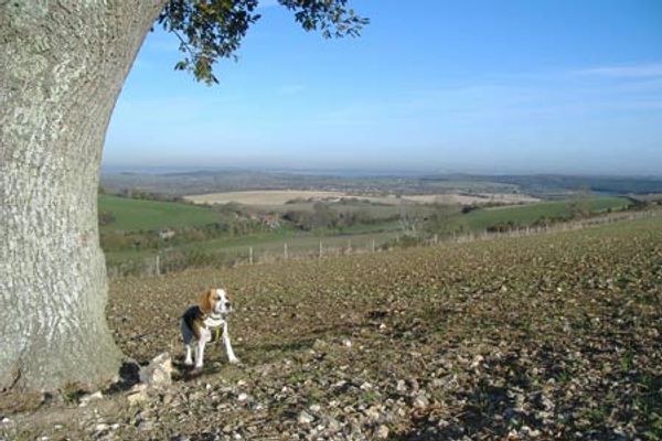
Carisbrooke, Bowcombe Down & Upper Watchingwell
 WalkingFree!
 This walk starts from Carisbrooke and crosses Bowcombe Down to reach Ashengrove. The return to the start walks through Lower Watchingwell. A GPS File is available for download (see walk description).
Freshwater and Norton from Yarmouth, IOW
WalkingFree!This Isle of Wight walk explores a section of coast west of Yarmouth with views across the Solent. It continues by completing a circuit inland to Freshwater. The views throughout are good and with the paths well signed and numbered. A GPS File is available for download (see walk description).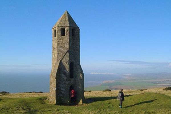
St Catherine's Hill & Coastal Path
WalkingFree!Isle of Wight walk from Whale Chine that climbs onto Catherine's Hill to enjoy the view and see the historic oratory. The route then descends to the coast and follows the Coastal Path over Gore Cliff, through Blackgang and Chale to finish the circuit along Walpen Chine. A GPS File is available for download (see walk description).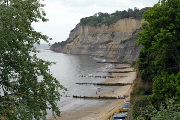
Shanklin to Sandown
WalkingFree!A straightforward walk along the cliffs and coast following the Isle of Wight Coastal Path. This linear route uses the frequent bus service to return to the start. A GPS File is available for download (see walk description).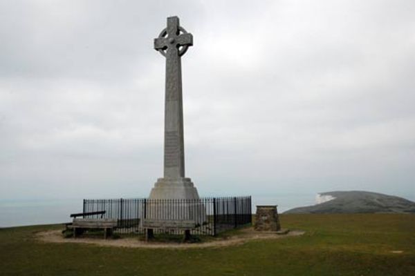
The Needles & Tennyson's Monument from Nodewell Farm
WalkingFree!This walk explores the far west of the Isle of Wight. The route climbs to the Tennysone Monument set high on Tennysone Down before walking to the viewpoint overlooking the Needles. In addition you get fine views of Alum Bay. A GPS File is available for download (see walk description).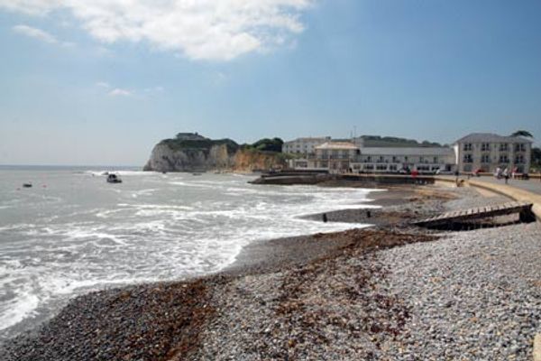
The Needles & Tennyson's Monument from Freshwater Bay
WalkingFree!The chalk downs at the western end of the Isle of Wight offer some excellent walking. This route starts from Freshwater Bay and visits the Tennyson Monument before continuing to the Needles at the far end of the island. The route also offers a good view of Alum Bay and on the final descent a grand panorama looking east along the coast to St Catherine's Point. A GPS File is available for download (see walk description).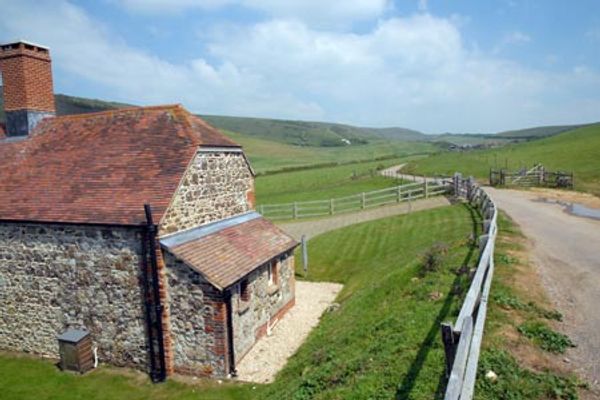
Compton Down and Five Barrows from Compton Chine
WalkingFree!This Isle of Wight walk explores the chalk downs to the east of Freshwater. The route offers some spectacular views along the coast. A GPS File is available for download (see walk description).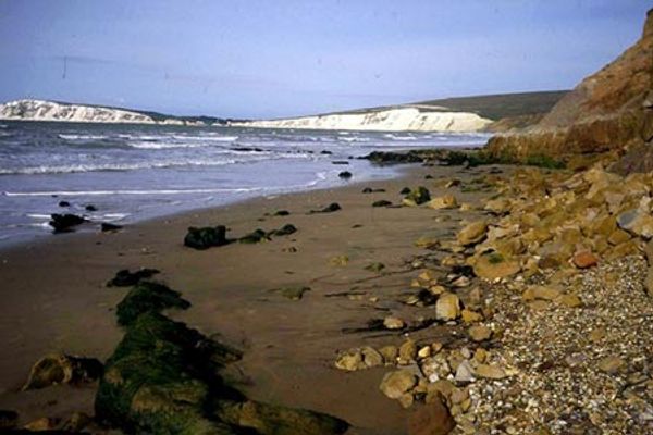
Compton Down from Brighstone circular
WalkingFree!This Isle of Wight walk includes excellent ridge walking on the downs and a lengthy section of the coastal path. The route visits the pretty village of Brighstone, offers fine view from the downs and wonderful seascapes from the cliff-top section making a wonderful day in the outdoors. A GPS File is available for download (see walk description).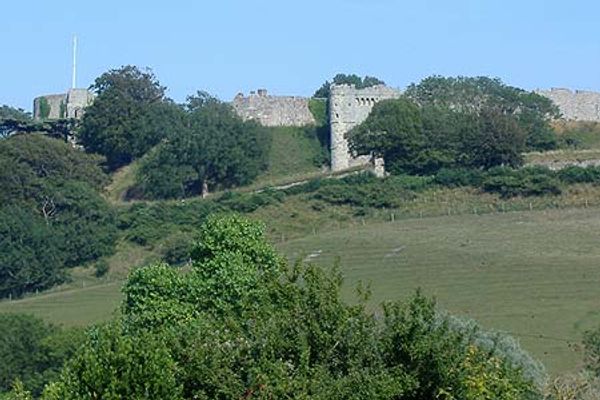
Gatcombe and Shorwell from Carisbrooke, IOW
WalkingFree!This Isle of Wight walk takes you through the hamlets of Gatcombe and Chillerton and back over Westridge and Dukern Downs to Carisbrooke. For many the highlight of the walk are the lovely views of Carisbrooke and the Castle, which provide a superb finale. A GPS File is available for download (see walk description).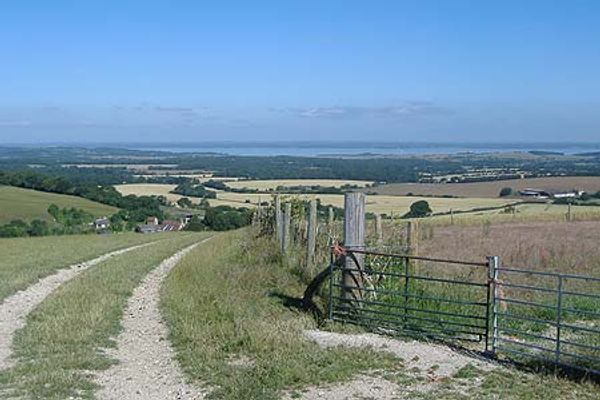
Bowcombe Down from Carisbrooke, IOW
WalkingFree!This short walk on the Isle of Wight takes you onto the downs west of Newport and offers good views to the mainland. In addition you get a fine view of Carisbrooke Castle and St. Mary's Church on the way back. A GPS File is available for download (see walk description).
Road cycling on the Isle of Wight.
 Cycling<!-- converted from markdown --> You can expect a great experience cycling the many available roads in this wonderful part of the countryside the UK has to offer.<br />NOTE - We’ve changed how we operate due to Covid-19 with your health and safety in..
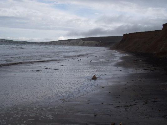
Compton Bay Beach
 Outdoor swimmingFree!Compton Bay is a rural beach on the south west coast of the Isle of Wight. From the foot of the cliffs the beach shelves gently and consists mostly of sand. At high tide the sea covers most of the beach. The beach is popular for surf sports.
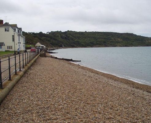
Totland Bay Beach
Outdoor swimmingFree!Totland Bay is a small rural beach located at the north western end of the Isle of Wight which enjoys panoramic views of the Solent. The sandy beach slopes gently into the sea. There are cafes and facilities close by.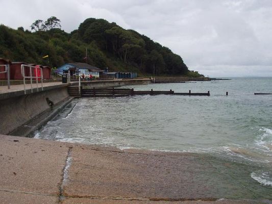
Colwell Bay Beach
Outdoor swimmingFree!Colwell Bay is a small resort situated on the north west coast of the Isle of Wight with panoramic views of the Solent and Hurst Castle. The sandy beach slopes gently. The area has several café's and facilities close by.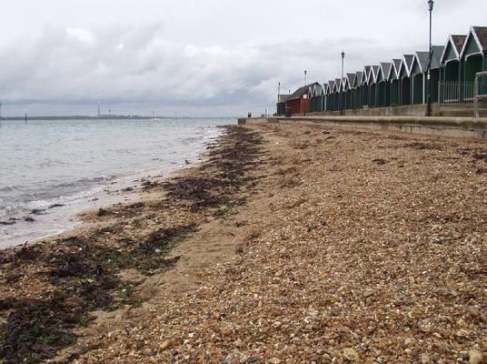
Gurnard Beach
Outdoor swimmingFree!Gurnard is a small resort situated on the Isle of Wight, west of Cowes, facing across the Solent to the New Forest shore. The gravel beach slopes gently into deep water where the currents can be strong. There are various facilities along the esplanade. The Gurnard Luck river flows to the sea just to the west of the beach and there are two storm outfalls.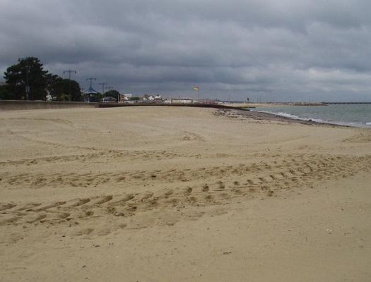
Ryde Beach
Outdoor swimmingFree!Ryde Beach is a long, straight sandy resort to the north of Ryde Town Centre on the northeast coast of the Isle of Wight. To the east of the long pier and marina the sandy beach extends far out at low tide. The Town esplanade with its swimming pool and canoe lake allows easy access. The Monktonmead Brook, crossing the beach to the west of the designated sampling point, is often contaminated with bacterial pollution.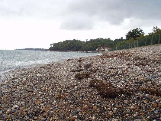
Seagrove Beach
Outdoor swimmingFree!Seagrove is a small bay situated on the east coast of the Isle of Wight. Measuring less than 1km in length, the bay slopes gently, with channels and sandbanks at low tide. The beach is mainly sand. Two streams cross the beach and there is a sewage overflow just offshore at the north end that could operate in response to significant rainfall.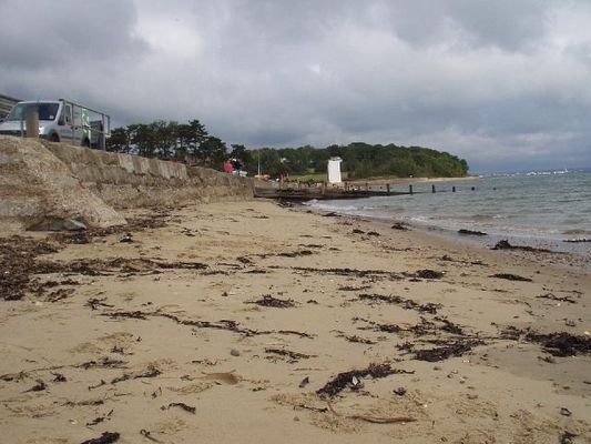
St Helens Beach / Estuary
Outdoor swimmingFree!St Helens is a small bay situated on the east coast of the Isle of Wight at the mouth of Bembridge Harbour. Measuring less than 1km in length, the sandy beach slopes from the seawall into the harbour entrance channel. There is a café and beach huts on the promenade that stretches along the beach, with sand dunes at the rear.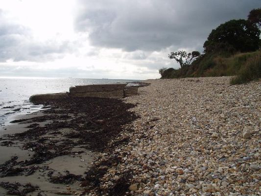
Bembridge Beach
Outdoor swimmingFree!Bembridge Beach is situated on the east tip of the Isle of Wight beside the Lifeboat Pier. The sandy beach faces east towards Selsey Bill and slopes gently onto rocky platforms with rockpool areas. The rocky platforms drop away nearer low water. At high water there can be little beach left. A café, car park, public toilets and RNLI shop are all nearby.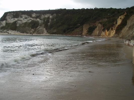
Whitecliff Bay Beach
Outdoor swimmingFree!At the eastern tip of the Isle of Wight, Whitecliffe Bay is famous for the well-exposed sedimentary rock sequence which yields an abundance of fossils. The mostly sandy beach slopes gently up to the base of the cliffs. At the southern end there is a rock ledge.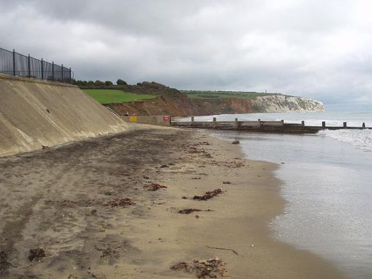
Yaverland Beach
Outdoor swimmingFree!Yaverland beach on the south east coast of the Isle of Wight is at the north end of Sandown Bay. The sandy beach slopes gently up to a sea wall backed by a car park close to the zoo. Toilet facilities are in the car park. The beach is popular with a wide variety of water sport enthusiasts including angling.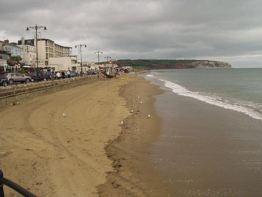
Sandown Beach
Outdoor swimmingFree!Sandown beach on the south east coast of the Isle of Wight is near the centre of Sandown Bay. Flanked by the pier the sandy beach slopes gently up to a sea wall backed by the esplanade at the centre of the resort.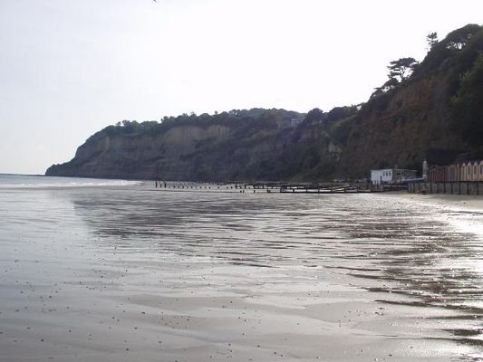
Shanklin Beach
Outdoor swimmingFree!Shanklin beach on the south east coast of the Isle of Wight is towards the south of Sandown Bay. The southern half of the sandy beach slopes gently up to the cliffs with a rock ledge at its extremity and the northern half is backed by the resort's esplanade. The beach is popular with anglers.. A stream flows to the beach from Shanklin Chine.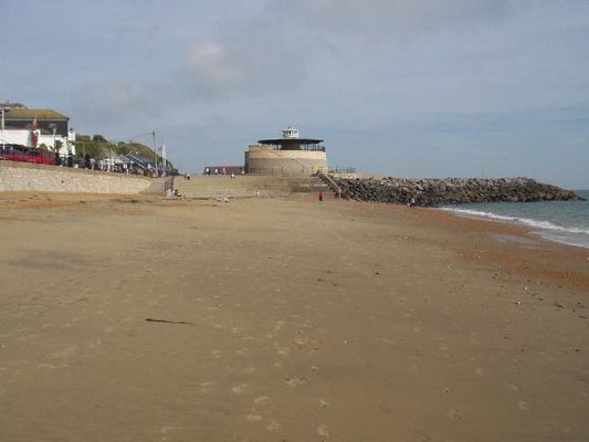
Ventnor Beach
Outdoor swimmingFree!Ventnor Bay is a small resort beach situated on the south coast of the Isle of Wight. Measuring 300m in length, the part sand, part fine shingle beach slopes gently into the sea. There are many hidden rocks and the tide is very strong. Adjacent to the beach are pubs, cafes, amusements, paddling pool and seafront car park.